
Resources
|
MAPS Scroll down to view thumbnails of each map. |
|

|
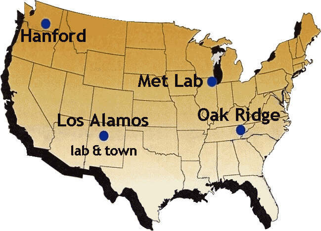
Places map |
"Signature Facilities of the MED" map |
|
|
Hanford map |
Hanford (black and white) map |
Hanford Site Diagram |
|
Hanford Site Location Map |
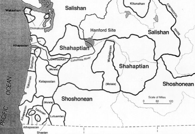
Hanford: Native Peoples map |
Hanford: Town map |
|
Map of Los Alamos, New Mexico |
Los Alamos: "Tech Area" map |
|
|
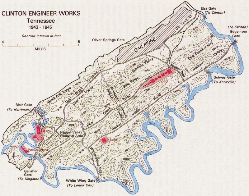
Map of Clinton Engineer Works, Oak Ridge |
Clinton Engineer Works, Oak Ridge (black and white)
map |
Oak Ridge: Projected Site for Atomic Production Plants,
1942, map |
|
Flight paths for Hiroshima and Nagasaki missions
map |
Map of the Trinity Test Site |
|
|
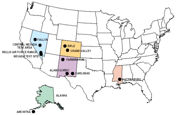
U.S. Nuclear Tests map |
||


Sources and notes for this page.
The text for this page is original to the Department of Energy's Office of History and Heritage Resources. The photograph of Leslie Groves looking at a map of the Pacific is reproduced from Vincent C. Jones, Manhattan: The Army and the Atomic Bomb, United States Army in World War II (Washington: Center of Military History, United States Army, 1988), 531. The sources for the maps are as follows:
Manhattan Project: General
- All Facilities: Jones, Manhattan, 63
- "Places" Map: the base map of the United States is taken from the History Office publication: The Signature Facilities of the Manhattan Project (Washington: History Division, Department of Energy, 2001); the labels are original to the Department of Energy's Office of History and Heritage Resources
- "Signature Facilities of the MED": reproduced from Signature Facilities, 2001)
Hanford
- Hanford: Jones, Manhattan, 213
- Hanford (black and white): reproduced from the History Office publication: Richard G. Hewlett and Oscar E. Anderson, Jr., The New World, 1939-1946: Volume I, A History of the United States Atomic Energy Commission (Washington: U.S. Atomic Energy Commission, 1972), 225
- Hanford: Diagram: reproduced from the "Smyth Report," which is Henry DeWolf Smyth, Atomic Energy for Military Purposes: The Official Report on the Development of the Atomic Bomb under the Auspices of the United States Government, 1940-1945 (Princeton, NJ: Princeton University Press, 1945); the Smyth Report was commissioned by Leslie Groves and originally issued by the Manhattan Engineer District; Princeton University Press reprinted it in book form as a "public service" with "reproduction in whole or in part authorized and permitted"
- Hanford: Location: courtesy the Hanford Site
- Hanford: Native Peoples: courtesy the Hanford Site
- Hanford: Town: courtesy the Hanford Science Center, Department of Energy; the map is reprinted in Peter Bacon Hales, Atomic Spaces: Living on the Manhattan Project (Urbana and Chicago: University of Illinois Press, 1997), 102
Los Alamos
- Los Alamos: Jones, Manhattan, 330
- Los Alamos: "Tech Area": reproduced from Edith C. Truslow, with Kasha V. Thayer, ed., Manhattan Engineer District: Nonscientific Aspects of Los Alamos Project Y, 1942 through 1946 (Los Alamos, NM: Manhattan Engineer District, ca. 1946; first printed by Los Alamos Scientific Laboratory as LA-5200, March 1973; reprinted in 1997 by the Los Alamos Historical Society), 18
Oak Ridge
- Oak Ridge: Jones, Manhattan, 131
- Oak Ridge (black and white): Hewlett and Anderson, The New World, 121
- Oak Ridge: Planned Facilities, 1942: Jones, Manhattan, 48
Other
- Hiroshima and Nagasaki Missions: reproduced from the History Office publication: F. G. Gosling, The Manhattan Project: Making the Atomic Bomb (DOE/MA-0001; Washington: History Division, Department of Energy, January 1999), 52
- Trinity Test Site: Jones, Manhattan, 479
Post-War
- U.S. Nuclear Tests: United States Nuclear Tests, July 1945 through September 1992 (DOE/NV-209-REV 15; Las Vegas, NV: Nevada Operations Office, Department of Energy, December 2000), xiv.
Home |
History Office
|
OpenNet
| DOE |
Privacy and Security Notices
About this Site |
How to Navigate this Site |
Note on Sources |
Site Map |
Contact Us